International Journal of Civil Infrastructure (IJCI)
ISSN: 2563-8084

Volume 4 - Year 2021- Pages 109-115
DOI: 10.11159/ijci.2021.014
Sinergetic Regulation Water Chemical River Mode by Global Warming
Nazarenko Oleksiy1; Nazarenko Iryna1; Ryabenko Alexandr2; Donenko Iryna1; Ishchenko Olena1
1National University “Zaporizhzhia politechnica”, Building department
Zukovskogo str, 64, Zaporizhzhya, Ukraine, 69006
Alexnazar75.an@gmail.com; irina842@gmail.com; e.l.fenenko@gmail.com
2National University of water and environmental engineering,
Department of heat energy, hydro energy and gydravlic mashines
Soborna str., 11, Rivne, Ukraine, 33028
o.a.ribenko@nuwm.edu.ua; donenko@gmail.com
Abstract - Bathymetric sensors were installed in characteristic sections of the Konka river to collect data of level changes and quality of the hydrological resource. Data were collected on annual runoff, sediment accumulation at the bottom of the river, and operational forecasts of risk phenomena for business owners and farmers. Improving the energy efficiency of an enterprise amid rising electricity tariffs is an important task for owners. Reducing operating costs for re-water conditioning is possible due to the introduction of advanced treatment and conditioning technologies, as well as taking into account the quantity and quality of wastewater discharged. This value will serve as a reserve for balancing water at region’s reservoir. The geometric parameters of the recreational lake were studied depending on the morphological parameters of the re-waters of the enterprises. To improve the dynamics of the biodiversity development, software shells were developed to test the quality of the aquatic environment and reuse water to replenish the pool of the reservoir. The technology of water supply for preliminary coagulation of suspended solids by means of cavitation deposition has been improved. For complex accounting of conditionally pure water, it is proposed by ultrafiltration with immobilized enzyme membranes. Depending on the volume of discharged water, they work to restore the fresh resource. The recovered resource falls into the basin of the reservoir and reduces the anthropogenic load on the buffer zone of the reservoir between the cities. Restoring the buffer zone resource, biodiversity is being updated and fauna - protozoa is being restored. For the productive work of the regional water regulators, auxiliary programs have been developed for forming a mixture and regulating river flow. A productive joint work of the regulator and scientific experts is proposed to identify the crisis areas of water disposal.
Keywords: sensors, sediment, geometrical parameters, hydrological mode, chemical balance, hydrological potential.
© Copyright 2021 Authors - This is an Open Access article published under the Creative Commons Attribution License terms. Unrestricted use, distribution, and reproduction in any medium are permitted, provided the original work is properly cited.
Date Received: 2020-11-03
Date Accepted: 2020-11-13
Date Published: 2021-04-28
1. Introduction
Natural reproduction of hydrological resources is possible with the successful combination of important factors - the vision of business owners the need for greening, regional regulators support of the initiative of business owners, natural opportunities for reversing resource quality, prompt prevention of service personnel of crisis phenomena, strategic models climate features for the region. The introduction of integration mechanisms of water basin will affect the investment policy of enterprises, create social development opportunities. The interest of supporting hydrological regulators is possible by technology transfer, greening and investment expectation from the implementation of measures. The impact of higher education institutions and research centers is economically undervalued due to the imperfect transformation of expert opinion in the enterprise.
2. Recent Research and Measurement
It is natural to determine the morphological changes in the cities wastewater, but the results of the influence to water-chemical balance of the reservoir are not given. Cities, where industrial enterprises are located, forced blending occurs naturally, but regulation for sustainable community development is not shown. For the development of new technological schemes of enterprises it is useful to know the multicomponent composition of the reservoir bed, and its possibility. The emergence of anthropogenic phenomena in risk regions has circulation impact to chemical composition of the reservoir bed bottom components. Suspension of anthropogenic phenomena will stabilizing the chemical and morphological mode of the reservoir. The formation of reservoir bed by relief-resistant materials suspends the landslides and the channel flow in highlands. The use of digital simulation helps in operational regulation and strategic planning. Organic morphology waste helps to accelerate the processes of fuel gasification, such devices should be introduced to identify the desired morphology.
3. Experimental Methods and Aparatus
The needs of society and the greening of enterprises have influenced the introduction of on-line monitoring of bathymetric sensors in the characteristic crossings in Konka river: TDS meter, saltmeter, express tests of water rigidity, alkalinity, oxidation. Implementation the results of developed bathymetry programs, water mode, mixture, helps in operational and strategic planning of regional reservoir modes.
3.1 Results of Bathymetric Data
The approach explores the localized dynamics of the tidal amplitude of the water level. The synchronous assumption makes it possible to raise the determined gradients directly from the amplitude of the tidal heights. Solutions obtained for the triangular shape of the lake c = (g × D)0,5. Equivalent results for a rectangular cross-section implies velocity change c = (0,55 g × D)0,63. Dynamic solutions are reduced to the functions ξ*, D and the friction coefficient of the reservoir bed f.
3.2 Results of Momentum Study and Continuity Equation
By lowering the convective term from the momentum equation, one can describe the tidal distributions in a recreational lake:


where U – liquid flow velocity; ς - water level; D - water depth; H - total water depth (H = D + ξ); f - layer friction coefficient (~ 0,0025); B - channel width; A - cross-sectional area; g - gravitational acceleration; t - time.
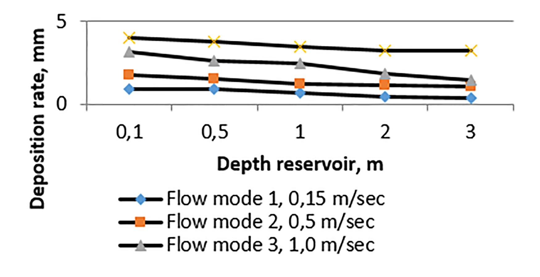
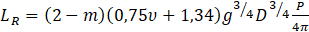
The assumption of a synchronous lake shows small axial variations ξ*. The solutions obtained for U* (Fig. 1) indicate an additional assumption, exceptionally for shallow rivers. The following triangular section with constant lateral slopes, (2) reduces to:

The study was conducted in the Konka river of the Pologovsky district of Zaporizhzhya region. The sensors are located in characteristic sections, near drainage collectors of the enterprises. The research data of the flow modes in reservoir is shown in Fig. 1.
The hydrology characteristics of the sychronous lake is:

Where SL = ∂D / ∂x


The program obtain for each diameter of the sediment fraction own recommended length of lake, for sedimentation. Regulators with region specific features shall recommend efficient hydraulic modes for enterprises service manager. Assuming F ≫ ω, the value of amplitude can be determined:

where x0 = L - X.
Substituting X = 0 and D = D0 as the basis, the lengths of lakes:
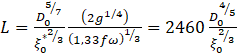
Dependence on D04/5/ς*1/2 in (9) and Fig. 1 indicates that the lakes length is much more sensitive to D. Former studies shows the expression for estuarine length is broadly consistent with lakes located around the Azov coast. For lakes, which sludge content estimates (450… 490 mg/l), allowing some discrepancies between the observed and estimated values.
3.3 Studies of Mixture Formation.
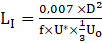
Interest in mixed or partially mixed lakes is based on the feasibility of using the body of the lake for hydrological mixing and sedimentation processes. The study proves that, temporarily vertically, a constant relative gradient of axial density, Sx = (l/ρ) (∂ρ/∂x) is linearly proportional to the salinity of water. Previous studies have shown the following expression: for the length of saline penetration, LI, into the buffer volume of mixed lakes:
The results are related to the determination of the location impurity invasion along the movement of the lake to derive the main indicators of the penetration zone.
For intermediate quantities, 1h <TK < 6h, inter-tidal stratification is probable, especially due to tidal runoff.
The impact of wastewater is equal to more than 3/4 of the salinity of the lake:
The xi values include hydraulic compensation for reducing the inflow velocity as the depth decreases, and ignore axial flow changes. Tidal expansion of saline solutions:

Research equation of mathematical model taking into account constant factor:
Y = 51,355-0,614x1-3,25x3-0,528x12 + 0,936x32 + 0,823x1x3
3.4. Research The Impact Of The Anthropocene On The Water Quality Of The Dnieper River.
In addition to the direct effects of warming, climate models predict changes in regional precipitation patterns and greater overall variability in precipitation, leading to increased frequency, magnitude and unpredictability of floods and droughts in many regions. Reduction of snow in mountainous regions will reduce flows. Warming will also lead to earlier melting of snow, causing changes in the seasonal hydrology of the host pools.
Climate change will reduce the availability of fresh water in many areas due to increased losses from evaporation and human use, as well as increasing water temperatures, both additive and synergistic with other stresses such as nutrient pollution and the spread of exotic parasites. Small bodies of water are likely to suffer from climate change at first, as they have less thermal and hydrological buffering capacity and are more affected by local precipitation patterns.
The warming temperature will exacerbate current water pollution problems, as increased water losses will reduce the amount of water in lakes, streams and wetlands, effectively concentrating pollutants and reducing leaching of these materials. Along with the obvious environmental consequences, the level of pollutants will increase and water treatment costs will increase accordingly.
Algae growth will change the structure of the community and reduce the availability of dissolved oxygen, causing damage to freshwater organisms.
Elevated nutrient levels and water temperatures may initially increase biodiversity in the cold, nutritious pores of the lake, whereas similar nutrient-rich changes are likely to result in: reduction of biological diversity due to reduced ability to store oxygen. Warming can also directly affect the availability of nutrients and other materials.
Climate change will change the biotic conditions for many organisms. In summer, the lake mixes with long periods of summer stratification. Extended stratification will increase the likelihood of anoxia in cool, deep-water environments.
Freshwater habitats are likely to face the greatest loss of biodiversity and, consequently, the functioning and stability of the ecosystem. For aquatic insects, like many butterflies, a water heating temperature only 2..3 ° C above optimal can significantly reduce the number of eggs produced by females, which is important for the future butterfly population, predatory fish production and overall ecosystem health. Rising temperatures can also desynchronize the life cycles and seasonal phenologies of consumers and their resources, the pattern of growth of flowers and pollinators, as well as in freshwater and marine food networks.
Global climate change has led us to a non-analog world where it is difficult or impossible to predict hydrology based on past patterns. A mechanism for understanding the hydrological process combined with reduced global circulation is needed to predict the future availability of water in different regions, as well as drought and flood patterns that will affect human society.
As an illustration, the inflow of precipitation of the average concentration of coarse substances is planned at about 100 mg / l per 10 m of water depth is about 0.35 mm, or 25 cm per year.

де
![]()
where L - the length and depth of the estuary (at the mouth); D - depth of the estuary (at the mouth); m - power axial change depth; n- width of the variation.
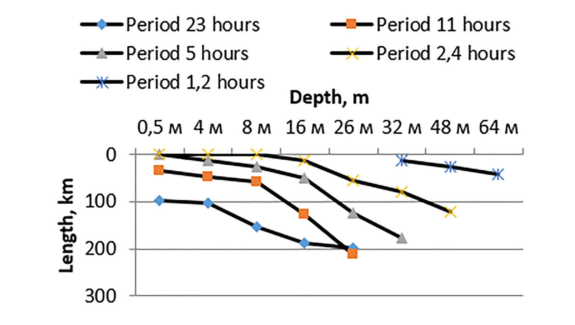
Estuary length (LR) determined for maximum sediments:
Tidal range in the river Konka rised from 2… 4 m above the extreme events from autumn to spring. The river was widely studied because of its vital role in shipping. "Narrow" at the mouth of a 4,5-kilometer river about 15 m deep with a depth of 1,5 m (Nazarenko, 2019). Tidal currents through this area may exceed 2 m / s.
According to scenario 2 (technogenic environment), this value can increase threefold, in a limited time space. The third proposed scenario (cavitation treatment of industrial effluents in a recreational lake) results in 146 mg / l at a depth of 6 m, which is 0.39 mm (28 sm / year). Thus, the simulation should work out future scenarios to cover the responses to the entire spectrum of forced cycles.
The outbreak of sediments is concentrated in the estuaries, due to the excitation of sediments and changes in bathymetric dimensions (length, depth and shape) coincides with the node with the following resonant gain:
For recreational lake (m = n = 0.8, ν = 1.5), LR = 37 D1/2 (km) or 94 km for the average observed depth, D = 6.5 m. This emphasizes that only the longest lakes, such as Mokra Moskovka, may show significant tidal gain.
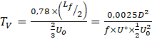
Use equation (12) for the length of the synchronous lake:

With the coefficient of friction of the bed f = 0, 0025 and θ * amplitude of the tidal volume. To inserting (13) in (15), derive the following expressions for resonant values:

3.5 Influence of Monitoring For the Increasing Water Potential
Linked hydrodynamic and mixing models and mixing of pollutants both horizontally and vertically are required as a basis for modeling sediment transport. Dynamic processes occurring in seconds (turbulent movements), up to hours (tidal fluctuations), lunar (seasonal fluctuations) with the corresponding spatial scales from millimeters to kilometers.
The diversity of lakes makes it unlikely to develop a single integrated model. Moreover, maintaining flexibility at the module level is necessary and desirable to provide a wide range of applications and provide program forecasts.
To understand and quantify the full range of threats from GOK, the whole system requires models - the inclusion of impacts on marine biota and their consequences.
In practice, the relationship may be limited to the representation of physical indicators (statistical emulators) by the application of integrated parameters, such as stratification levels or multiplicity of dilution.
Need comprehensive surveillance networks using synergistic aspects of the full range of devices and platforms integrated with the simulation. Continuous on-site monitoring is likely to be the most expensive component of any surveillance network, and it is important to optimize such a network.
To assess current model developments required programs for monitoring test parameters, ideally they should extend to water levels, currents, temperatures and salinity, waves, turbulence, bed features, sedimentary, botanical, biological and chemical components:
- shore inflow sensors along the entire length of the lake, supplemented by a level sensor in deeper channels;
- regular bathymetric studies, such as 10-year intervals with more frequent re-surveys in areas of lakes;
- network of mooring platforms with tools for measuring currents, waves, sediment concentration, temperature and salinity.
The practical use of the tool is to planing different scales of man-made load for short-term and long-term project periods:
Strategy 1 (5%) - research models, strategic planning of river basins, annual runoff, amount of sediments, volume of fresh resources.
Strategy 2 (50%): research models in which algorithms, numerical grids and schemes are developed using specific measurements in the enterprise and technological research.
Strategy 3 (75%): previous operational models with (productive) fully developed algorithms for evaluation and development (from time measurement of observations or accumulated reservoir beds).
Strategy 4 (95%): operational models in everyday use and are usually supported by a constant monitoring network.
4. Discussion
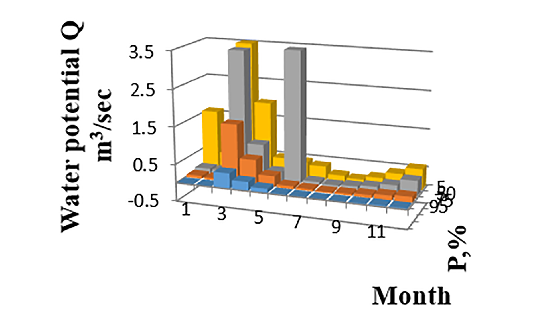
The convenience of numerical simulation planing different scales of man-made load for short and long project periods. Fig. 8 presents the simulation of the development of the basin according to the operational scenario (95%) and strategic planning (5%) in the presence of appropriate hydrological GPS sensors. Operational use in real time sends out warnings about the danger of storms, electric surges, movement of oil or chemical spills, search and rescue, eutrophication of toxic algae.
4. Conclusions
The current study allows to visualize the water, environmental and biological risks of a technogenic metallurgical region when interacting with the flora and fauna of the region:
- a mathematical model of the distribution of the restorative effect of the sedimentation process is obtained;
- for the first time the equation of expansion of salt solutions of recreational lakes is received;
- the methodology of concentration of bottom deposits depending on the coefficient of friction from 0,0025… 0,125 is offered;
- the optimal length of the lake to maximize sediments was identified;
- the software cover for calculation of directions of hydrological development of reservoirs is developed.
Acknowledgments
We express our gratitude to the employees of the Zaporizhzhya Regional Water Management for the provided opportunities for obtaining experimental data. Special thanks also to the Center for Metrology for timely and high-quality services for verification of equipment.
References
[1] Nazarenko O.M. Risk management of water users of the Dnieper River. Zaporizhzhia, STS Groop. 2018. 203 p.
[2] Jorgensen S.E.. Handbook of Ecological Models Used in Ecosystem and Environmental Management. Copenhagen, University Denmark, CRC Press.2011. 600 p.
[3] Semenov O.E. Introduction into experimental meteorology and climatology of sandstorms. Almaty.-2011 187 p.
[4] Shypulin V.D. Basic principles of neo-information systems. Kharkiv, KhNAHKh. 2010. 337 p.
[5] Hosocava T., Ivasaki M., Komatsubara H. Kurita Handbook of water treatment. Tokyo. Water Industries LTD, 2d izdanie.1999. 499 p.
[6] Markert B.A., Breure A.M., Zechmeister H.G. (eds) Bioindicators and biomonitors. Principles, concepts and application. Handbook. Oxford. Elsevier. Science Ltd. 2003. 1017 p.
[7] Drozdova H.H. . Methodology for determining the cost-effectiveness of conservation of nature. Kyev, KHTU.-2004. 12 p.
[8] Patent UA №123556, MPK, F17D5/02/2006. 01. Sistema vіddalenogo monіtoringu parametrіv teplonosіja u dvotrubnih teplovih merezhah [System for remote monitoring of coolant parameters in two-pipe heat networks] Nazarenko O.M., Bіchenko K.O. № U201710667, zajavl.02.11.2017, opubl. 26.02.18, Bjul.4 (in Ukrainian).
[9] Epoyan S.M., Yarkin N.A., Sukhorukov G.I. Corridor-Type Baffles Mixing Basin with cross porous barriers. Nauka ta progress transportu. 73/1. 2018.p.24-32. View Article
[10] Cherniuk W.V., Riabenko O.A., Ivaniv V.V. Influence of transit water flow rate on its dispensation and on flow throught nozzles in pressure pipelines under action of external pressure. Journal of civil engineering. 12/2 2017. p.139-146. View Article
[11] Morphological Changes of the Lower Ping and Chao Phraya Rivers, North and Central Thailand: Flood and Coastal Equilibrium Analyses. Open Geosciences. De Gruyter. DOI 10.1515/geo-2019-0013. Chaiwongsaen Nikhom, Nimnate Parisa, Choowong Montri. 2019. р.152-171 View Article
[12] Binary Component Sorption Of Cadmium, And Copper Ions Onto Yangtze River Sediments With Different Particle Sizes Sustainability. Mdpi Ag. 2017; 9(11): 2089 Doi 10.3390/Su9112089. Jianxin Fan,Guoliang Zhaо, Jiaoxia Sun. View Article
[13] Numerical Simulation of the Interaction between Phosphorus and Sediment Based on the Modified Langmuir Equation. Water. MDPI AG. 2018; 10(7). DOI 10.3390/w10070840. Pengjie Hu,Lingling Wang, Zhiwei Li, Hai Zhu, Hongwu Tang. Р. 840-844. View Article
[14] Sulphate Removal From Water By Carbon Residue From Biomass Gasification: Effect Of Chemical Modification Methods On Sulphate Removal Efficiency. Bio Resources. North Carolina State University. 2016; 11 (2). Doi 10.15376/Biores.11.2.3136-3152. Hanna Runtti, Sari Tuomikoski, Teija Kangas, Toivo Kuokkanen, Jaakko Rämö, Ulla Lassi. Р. 3136-3152. View Article
[15] Nazarenko Oleksiy, PhD, Building Department, Zaporizhzhia Politechnica, 69006, Zaporizhzhya, Zukovskogo str., 64, alexnazar75.an@gmail.com, (corresponding author)
[16] Nazarenko Iryna, PhD, Heat Department, Zaporizhzhia Politechnica, 69006, Zukovskogo str., 64, irina842@gmail.com,
[17] Ryabenko Olexandr, ScD, Head of Department of heat energy, hydro energy and gydravlic mashines,
[18] National University of water and environmental engineering
[19] 33028, Rivne, Soborna str., 11, o.a.riabenko@nuwm.edu.ua
[20] Donenko Iryna, PhD, Building Department, Zaporizhzhia Politechnica, 69006, Zaporizhzhya, Zukovskogo str., 64, donenko@gmail.com